Ortofotomapa
Dane i zasoby
-
Ortofotmapy WMSWMS
Ortofotomapy w usłudze WMS. Dostępne układy współrzędnych: 2179 2180 3857 4326
-
Ortofotomapa 2025 (GeoTIFF COG)geotiff
Ortofotomapa wykonana w kwietni 2025 roku.
-
Ortofotomapa 2023 (GeoTIFF COG)geotiff
Plik należy dodać np. do programu QGIS, jako raster po protokole http/https.
-
Ortofotomapa 2022 (GeoTIFF COG)geotiff
Plik należy dodać np. do programu QGIS, jako raster po protokole http/https.
-
Ortofotomapa Ukośna 2022 Zachód (GeoTIFF COG)geotiff
-
Ortofotomapa Ukośna 2022 Wschód (GeoTIFF COG)geotiff
-
Ortofotomapa Ukośna 2022 Północ (GeoTIFF COG)geotiff
-
Ortofotomapa Ukośna 2022 Południe (GeoTIFF COG)geotiff
-
Ortofotomapa 2021 (GeoTIFF COG)GeoTIFF
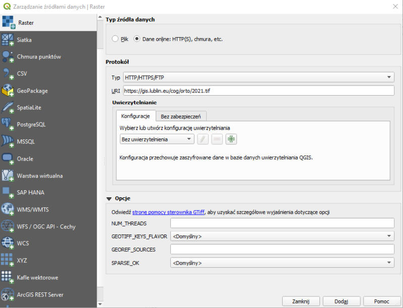
Plik należy dodać np. do programu QGIS, jako raster po protokole http/https.
-
Ortofotomapa 2020 (GeoTIFF COG)GeoTIFF
Plik należy dodać np. do programu QGIS, jako raster po protokole http/https.
-
Ortofotomapa 2019 (GeoTIFF COG)GeoTIFF
Plik należy dodać np. do programu QGIS, jako raster po protokole http/https.
-
Ortofotomapa 2018 (GeoTIFF COG)GeoTIFF
Plik należy dodać np. do programu QGIS, jako raster po protokole http/https.
-
Ortofotomapa 2017 (GeoTIFF COG)geotiff
Plik należy dodać np. do programu QGIS, jako raster po protokole http/https.
-
Ortofotomapa 2015 (GeoTIFF COG)GeoTIFF
Plik należy dodać np. do programu QGIS, jako raster po protokole http/https.
-
Ortofotomapa 2015 CIR (GeoTIFF COG)GeoTIFF
Plik należy dodać np. do programu QGIS, jako raster po protokole http/https.
-
Ortofotomapa 2013 (GeoTIFF COG)GeoTIFF
Plik należy dodać np. do programu QGIS, jako raster po protokole http/https.
-
Ortofotomapa 2012 (GeoTIFF COG)GeoTIFF
Plik należy dodać np. do programu QGIS, jako raster po protokole http/https.
-
Ortofotomapa 2012 CIR (GeoTIFF COG)GeoTIFF
Plik należy dodać np. do programu QGIS, jako raster po protokole http/https.
-
Ortofotomapa 2009 (GeoTIFF COG)GeoTIFF
Plik należy dodać np. do programu QGIS, jako raster po protokole http/https.
-
Ortofotomapa 2008 (GeoTIFF COG)GeoTIFF
Plik należy dodać np. do programu QGIS, jako raster po protokole http/https.
-
Ortofotomapa 2005 (GeoTIFF COG)GeoTIFF
Plik należy dodać np. do programu QGIS, jako raster po protokole http/https.
-
Ortofotomapa 2003 (GeoTIFF COG)GeoTIFF
Plik należy dodać np. do programu QGIS, jako raster po protokole http/https.
| Pole | Wartość |
|---|---|
| Ostatnio zaktualizowany | Grudzień 8, 2025, 08:14 (CET) |
| Utworzony | Listopad 21, 2021, 17:41 (CET) |

